It is 32C outside and the tarred road is simmering. Yet the unrelenting heat of the day does not take away the picturesque drive that is taking us from Puttalam to the Mannar Island, overlooking the Gulf of Mannar.
We cross the ‘Peace Bridge’, a 3 km causeway that connects Medawachchiya-Mannar-Thalaimannar along the A14 road and offers fabulous views on either side of the lagoon.

Our first stop is at the famous Baobab tree, introduced to Mannar by the Arab traders in circa 1477AD. Today, this massive tree with a circumference of 19.51m and 7.50m in height thrives in this hot and humid town and is a must-see attraction. During a certain time of the year, the tree sheds its leaves and then appears to be planted upside down.
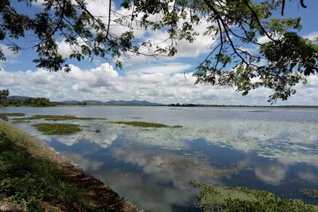
Our next stop is at the Yodha Wewa or Giant’s Tank, which is one of the largest tanks in the country. We stand awed at the banks of this massive tank, which was built by King Dhatusena (459-477) and fed by an ancient canal from the Malwatu Oya. As is recorded, the complexities of Sri Lanka’s ancient irrigation systems have baffled modern engineers and Dr. Ananda W.P. Guruge in The Waterlords of Ancient Sri Lanka (UNESCO Courier, Jan, 1985 ) describes this aptly: “Many a modern engineer has been baffled by the sophisticated designs on which these reservoirs and channel systems were constructed. It is known that the Dutch engineers of the eighteenth century and their British counterparts in the nineteenth failed to understand the design of the giant tank near Mannar on the northwestern coast. Only in recent years, when the tank was restored in conformity with the original design, was it found that leveling by the unknown engineer of the past was vastly superior to that attempted by modern engineers.”
Yet, today, Mannar is relatively underdeveloped. Placid donkeys and nimble goats are quite an attraction along these dusty roads. Traveling on, we stop at the Fort at Arippu. The Fort remains unattended and its crumbling walls are overrun with wild undergrowth, goats, and gawking lizards. A signboard reads, ‘A small two bastion Fort originally built by the Portuguese and taken over by the Dutch in 1658 after the fall of Mannar’. It goes on to say that Robert Knox, the English sea captain who landed in Trincomalee in 1659 due to stormy weather and taken captive by the Kandyan King Rajasinghe II, escaped to this Fort after walking through Anuradhapura. His 19-year captivity ended after the Dutch transported him to Jakarta (a Dutch colony) after which he returned to England in 1680.
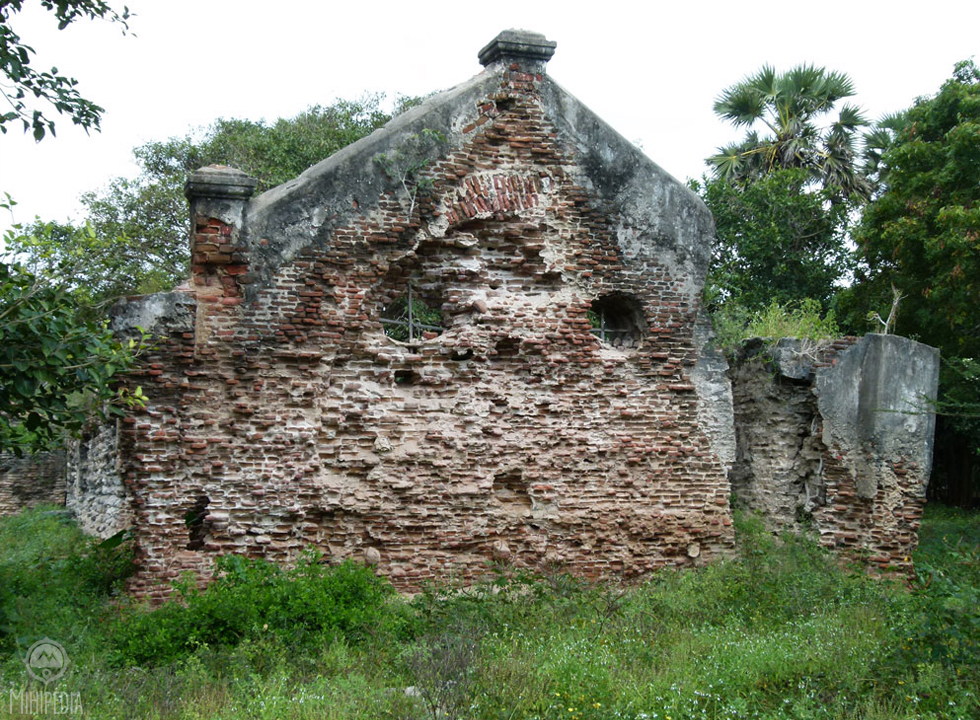
In 1795 the Dutch surrendered Mannar to the British. During this time, Frederick North, the first Governor of Ceylon converted this Fort into a bungalow for the officers supervising pearl fisheries in close proximity to the ‘Doric’- the mansion he built for himself in 1804.
The Doric bungalow is now in ruins and manned by Navy personnel who take refuge from the relentless sun under its remaining ramparts. I can only imagine the past glory of this awesomely located bungalow with its 180-degree panoramic view of the sea-blue ocean. The entrance overlooks vast tapered hills as far as the eye can see. North used this location to personally revive and supervise the country’s nascent pearl fisheries.

With the midday sun beating down on us we make our way to the Thiru-Ketheeswaram Hindu temple located at Mathoddam. We get here early and a priest informs us that the ‘pooja’ will begin later in the evening. This temple was one of the iswarams of Lord Shiva in Lanka long before the arrival of Vijaya in 600 B.C., which means it would have been around for at least 2500 years back.
Mathoddam was a centre for trade with the Greeks, Romans, Phoenicians, Arabs, Ethiopians, Persians, Chinese, Japanese, Burmese and others vying to monopolize the trade of North Ceylon with Tamil traders. According to historical literature, Mathoddam is the only port on the island that could be called a ‘buried city’, with much of the ancient ruins under sand today. The existence of the Thiru-Ketheeswaram temple attests to the antiquity of the port.
Incidentally, the other iswarams of Lord Shiva in Sri Lanka are Koneswaram (Trincomalee), Naguleswaram (Keerimalai), Tenavaram (Tevan Thurai), and Munneswaram (Puttalam).
Back on the road again, we head towards the Adams Bridge or Rama’s Bridge. This 30-km long chain of limestone shoals connects Thalaimannar on Sri Lanka’s coast to Rameshwaram off the Southeastern coast of Tamil Nadu. Steeped in folklore, there are numerous anecdotes that evoke imagination. In the early 1800’s the British named this Adams’ Bridge after the Islamic legend asserting Adam used this bridge to reach Adam’s Peak to stand on one leg for 1,000 years as penance for his lapses in Eden. The Ramanaya says Rama built this “bridge” with the assistance of Hanuman, the monkey god, to rescue Sita from Ravana, the demon king of Lanka.
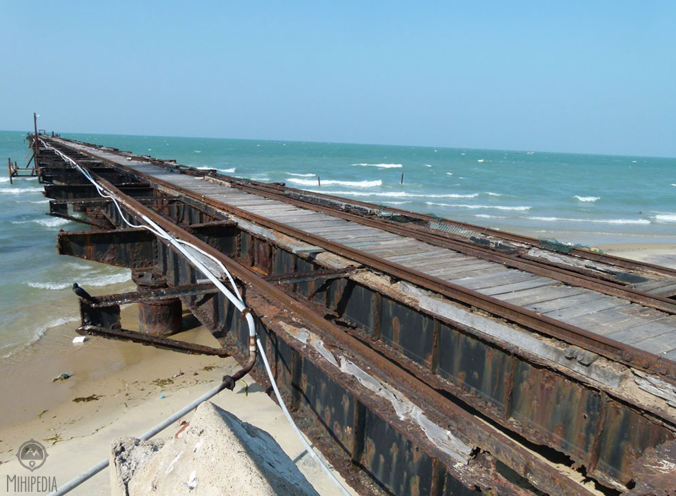
On land, the disused rail bridge juts out into the sea. Built by the British in 1894, it was primarily used to transport workers from Tamil Nadu to work on Sri Lanka’s tea plantations. However it was destroyed in 1967 by a cyclone.
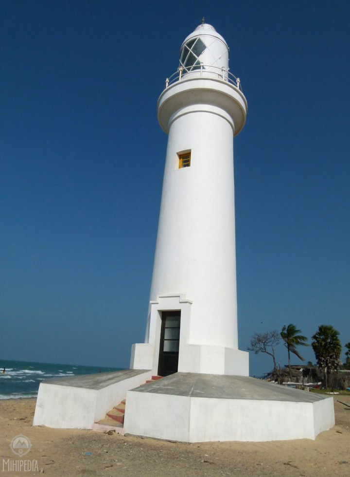
Beside it a lighthouse stands proudly showing off a new coat of paint. Also built by the British in 1915, its lantern guided approaching vessels out at sea.
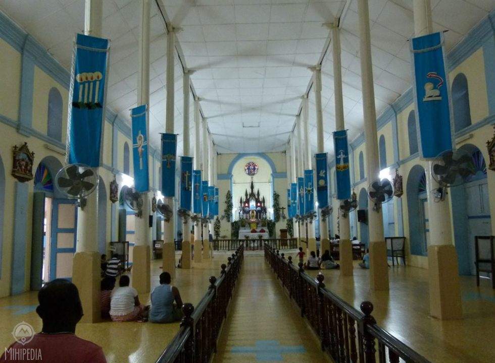
Our last stop for the day is the Shrine of Our Lady of Madhu. With a history of over 400 years, Tamils and Sinhalese revere this Roman Catholic shrine. During the war, despite being shelled many times it acted as a refugee camp. Today, devotees kneel in devout prayer as they ask for favors from the Lord above.
It is time to go. The day has been steeped in history and we have learnt that although the war may have left its indelible mark on all of us, this country must learn to live as one.

Mihiri. What a brilliant history lesson. Can’t agree with you more on the last paragraph. Well done.
LikeLike
Thank you. Incredible country. Sadly underestimated.
LikeLike